
A walk through time periods : from the gallo-roman Nogastrum to the nowadays Nouâtre
Nouâtre
A walk through time periods : from the gallo-roman Nogastrum to the nowadays Nouâtre
Easy
1h
997m
+4m
-4m
Embed this item to access it offline
Description
- Les Chaumes and the Vienne
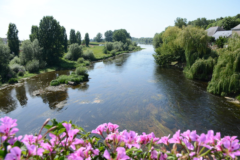
This promenade already existed in the 18th century and was planted with elm trees, one of which was chosen in 1790 as the “Arbre de la Liberté” (Tree of Liberty), but was cut down and sold in 1795. At the end of this promenade flows the Vienne river, where, until 1932, a ferry still allowed access to Marcilly, on the left bank. You can still see the old riprap providing access to this ferry, and on the other side, the old ferryman's house, which dates back to the 15th century. This is where the tourist trail starts (blue arrows). - Place Ludovic Bouchet
This square was laid out in the 19th century on the site of the garden of the large house at no. 17 rue de la Liberté belonging to notary Pierre-Emery Forest, mayor of Nouâtre from 1800 to 1843; it later became the presbytery and is now divided into three rental apartments. Born in 1881 and died in 1956, Ludovic Bouchet was mayor of Nouâtre from 1925 to 1945 and took part in the Resistance during the Second World War. - La Pierre du Faon
In the 15th century, a small walled castle stood here, commanding the entrance to the fortified village. Nearby was the headquarters of the religious order of the Temple, founded in the 12th century to take part in the Crusades. It is likely that the temple of the Gallo-Roman city of Nogastrum was located here. - Place du 8 mai 1945
The town hall is located on this square, which was laid out in the 19th century. On the facade, a plaque commemorates young André Saulquin, killed when the Germans entered Nouâtre on June 21, 1940, and the victims of Nazi barbarism during the Maillé massacre on August 25, 1945. - Place Alexandre Garnier
This square was created and laid out in the 1960s, on the site of a house that once belonged to the Garnier family. Son of Alexandre Garnier père, who was mayor of Nouâtre from 1920 to 1925, Alexandre Garnier fils, a farmer in Noyers, was mayor of Nouâtre from 1945 to 1971. - Le Clos du Bourg
Traces of Gallo-Roman buildings have been found in this vast area to the right of Rue Saint-Jean-du-Bois, which continues an ancient Gallo-Roman road. This area, known as Espace Coluche, is now the intercommunal gymnasium named after Marie-Amélie Le Fur, gold medalist in the 100-meter race at the London 2012 Paralympic Games. - Allée Romaine
The name of this street, extended by rue Guy de Nevers, recalls an ancient Gallo-Roman road that ran through Nogastrum. The portion concerning the territory of the Turons, the Gallic people who gave their name to Tours, headed towards Tours (Caesarodunum), via Nouâtre, Saint-Épain (Brigogalum) and Pont-de-Ruan (Rotomagum). - Rue du Vieux Lavoir and Donjon
This old by-pass road, which ran to Maillé, bears witness to the communal washhouse on the banks of the Biez stream, the canal that led to the banal mill. All remains were destroyed when the main pumping station for the wastewater treatment plant was built. Originally, this road was much lower, as evidenced by the 1915 flood mark on the lintel of the window at n°8 (la Ferme du Temple), where the remains of Nouâtre's former keep can be found. The motte was reused to raise the road when Nouâtre's first bridge was built in 1932. - Saint-Léger church
Jean du Fou, lord of Nouâtre, Sainte-Maure and Montbazon, chamberlain to King Louis XI, had this church built in honor of Saint-Léger, abbot of Saint-Maixent, bishop of Autun and advisor to several Merovingian kings in the 7th century. It replaced a 10th-century church dedicated to Saint-Révérend, who, according to tradition, became a hermit in Nouâtre, near a spring reputed to cure madness. The church features a 15th-century triptych depicting the Passion, with 43 finely sculpted figures, and a 16th-century fresco depicting the life of Saint-Révérend in 12 tableaux. - Liberty Tree
Contrary to popular belief, this tree was not planted on July 14, 1790, to celebrate the Fête de la Fédération, the first anniversary of the storming of the Bastille. In fact, this 25-metre-high pedunculate oak was planted in February 1848, to commemorate the Revolution that ended the reign of Louis-Philippe and established the Second Republic. - Castle
The name Nogastrum (le Nouveau Château or le Château des Noyers Sauvages) appears in the archives in 925, in connection with a judgement of God that took place there. It was a fortified wooden structure built on a motte castrale. In the early 11th century, Lord Guennon de Nouâtre became the vassal of the Count of Anjou, Foulques Nerra, who had the castle rebuilt in stone. The castle was restored in the 15th century by Jean D'Estouteville and Jean du Fou. The medieval town was defended by a moat, fed by the Biez river, and by a keep, also built on a motte castrale. A third motte castrale, on the left bank of the Vienne where Château de la Motte stood, protected the ford.
- Departure : Rue de la Liberté / Eglise St-Léger
- Arrival : Rue de la Liberté / Eglise St-Léger
- Towns crossed : Nouâtre
Forecast
Altimetric profile
Information desks
1 Rue Rabelais,, 37500 Chinon
Place du Marché, 37120 Richelieu
Report a problem or an error
If you have found an error on this page or if you have noticed any problems during your hike, please report them to us here: