
Through valleys and plateaux
Ports-sur-Vienne
Through valleys and plateaux
Easy
2h30
9,9km
+128m
-128m
Loop
Embed this item to access it offline
Description
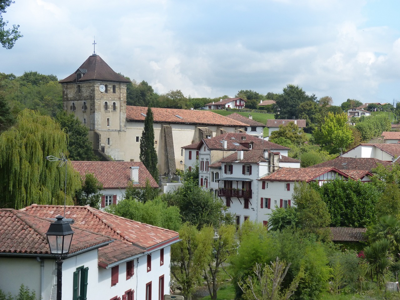
- Eglise Saint-Martin
Romanesque church of the Translation-de-saint-Martin, built in the 11th century and rebuilt in the 15th century; it retains the original cul-de-four apse and part of the nave, whose walls are of small-scale construction. The former comb belfry (similar to that of Noyers) has been extended by a slate-covered construction. The 15th- and 17th-century bells are listed as Monuments Historiques.
Cross Place Romain Rideau and take Rue des Jardins on your left. - Rest area
- Digital public space
- The communal washhouse, fed by a spring, is below the château on your left.
- Ports castle, of military design, dates from the 14th and 15th centuries. What remains today is a rectangular dwelling with stone cross-vaulted windows, built over a vast barrel-vaulted cellar. Since 1956, it has been occupied by a workshop of internationally renowned artists who create and weave original tapestries that can be admired in their gallery at La Martinerie in Amboise.
Before the château, turn right towards Les Cazeaux. In the hamlet, fork right and head downhill. Cross the D18 and go straight on towards the Vieux Port. - Lime kilns, interpretation point.
Continue along rue des Caves, take the 2nd right, cross the D18 and continue as far as Vienne. - The tile factory used to be on your left. The Napoleonic cadastre shows the layout of this factory, with its numerous buildings. The location of this production facility was linked to the presence of a thick silt layer. This activity ceased at the beginning of the 20th century. Tile debris still grazes the surface of the ground. Continue along the hallage path.
- The drama of 1880, a point of interpretation.
- The lowering of the Vienne river, interpretation point on the Vienne river crossings.
- A10 bridge
- High-speed train line bridge
- The Maisons Rouges dam was built in 1920 to supply the Descartes paper mills. In 1948, EDF took possession of the dam. Following the 1994 Plan Loire Grandeur Nature, the concession of the dam to EDF was not renewed. The State announced that it would be demolished. Despite strong local opposition, the dam was levelled between June 1998 and April 1999. What remains today is an invert, which we can see at low water in summer.
After the waste disposal site, turn left onto the D18, then take the track on your right towards Sauvage. - La Veude de Ponçay
- Sauvage (hamlet of Pussigny). At the end of the hamlet, you can join the Pussigny path.
On the D107 after the A10 bridge, turn right. - Panoramic view from La Mélandière.
- La Boucaire, former fortified manor house, also known as La Boutière; the central part was rebuilt in 1644 by Jacques Deffray, King's advisor and controller of the Sainte-Maure octroy deniers. The rectangular dwelling is flanked by two square towers at opposite south-east-north-west corners.
At the crossroads, go straight ahead. - The vineyard lodge was once used for storing equipment, shelter and refreshments.
Join the wood via the tree-lined driveway, then fork left and turn right at the exit. - La Chopinière, panoramic view.
- Sports area and arboretum.
- Departure : Place Romain Rideau
- Arrival : Place Romain Rideau
- Towns crossed : Ports-sur-Vienne and Pussigny
Forecast
Altimetric profile
Information desks
Place du Marché, 37120 Richelieu
77 Av. du Général de Gaulle, 37800 Sainte-Maure-de-Touraine
Report a problem or an error
If you have found an error on this page or if you have noticed any problems during your hike, please report them to us here: