
Val Joyeux lake
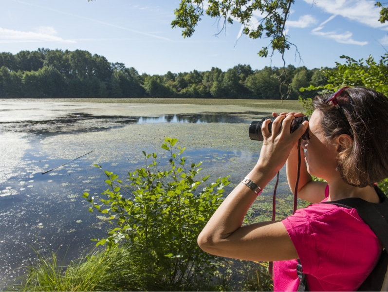
Val Joyeux lake
Easy
1h45
6,3km
+61m
-61m
Loop
Embed this item to access it offline
To see, to discover
nature among forest hills, vineyards, the Loire’s banks, lakes, meadows, rivers and more.
from Jean de Bueil, nicknamed the « plague of the English », to Louis XIV. Monument open to the general public.
landmarks and attractions be they big or small.
- Touraine Nature
nature among forest hills, vineyards, the Loire’s banks, lakes, meadows, rivers and more.
- Château de Vaujours
from Jean de Bueil, nicknamed the « plague of the English », to Louis XIV. Monument open to the general public.
- Cycling loops
landmarks and attractions be they big or small.
Attachment
- Downloadpdf
Topoguide FR-EN Le Lac du Val Joyeux
Description
- Place du Champ de Foire
Go on the street of the same name on the left and go straight on along Rue des Portes de Fer. Within the borders of Anjou and Touraine, there was already a fortress overlooking the Fare River below in the Middle Ages. - Forges district
Turn left onto a little lane to reach the Val Joyeux banks
that you follow on the right. You’re walking by the former forge district. The establishment made over 150 tons of iron per year in the mid-18th century. The forge was replaced by bark and fuller’s mills (cloth cleaning) then a tannery and saw mill. - Beach
Pass the dyke to reach the beach. This newly updated leisure area is very popular among tourists and locals in summer. The swimming area has lifeguards in July and August with children’s games, pedalos, a picnic area, beach volleyball,
boules, tennis, bar and more. - Lake’s left bank
Continue on the lake’s edge. You’ll reach the only boat
launch site. Combustion engines are not allowed here. The site is ideal for fi shing carnivorous fi sh: pike, zander, wels catfi sh etc. The large building on the other side of the lake used to be a hospital founded by Louise de la Vallière in 1675 and is now a retirement home. - Undergrowth
Leave the banks and go into the undergrowth in the shade of the oak, beech and chestnut trees then go along a grassy path lined with Touraine’s signature hedgerows known as «bouchures». Don’t be surprised to see markers
along the trail. An orientation course has recently been designed here. - Stone Menhir
The Stone Menhir stands before you in the middle of a clearing. This puddingstone (conglomerate of pebbles surrounded by natural cement) is 3.7m high but the underground section is almost 3m deep. It’s the tallest menhir in the region. The meadow around you is home to beautiful burnt-tip orchids in spring. - Fare Bridge
Go to the end of the lake and onto the little bridge over the Fare. The source of the trout-packed river is a few kilometres away and is listed as a category 1 waterway. Turn left and continue your walk by woods made up of willows,
hornbeams and oaks. - Château-la-Vallière forest
You’re on the edge of Château-la-Vallière forest. The forest area covers over half of the communal territory, mainly around Château de Vaujours. The wood was used in ovens
to heat forges and glassmakers. - Lake’s right bank
Stroll along the path winding along the banks and natural escarpment of the Fare Valley. The tour of the 36 hectare lake is at an end. Turn right onto the former Rue de l’Abreuvoir
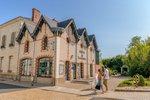
then right again onto Rue Basse Bretagne. - Notre-Dame Church
Go onto Rue de la Citadelle and by Notre-Dame Church.
It was rebuilt in the 19th century and still has its Roman doorway and oculus from the 11th century. Turn left onto Rue Lezay Marnesia and go past the large house surrounded
by an English-country garden that’s open to the
public. Feel free to have a stroll. This 18th century building has been home to the Town Hall since 1991. - Rue Monconseil
Before returning to the start point on Rue Monconseil, have a walk around the town centre which is now free of heavy traffic following the recent deviation.
- Departure : Château-la-Vallière, rue du 8 mai 1945
- Arrival : Château-la-Vallière, rue du 8 mai 1945
Altimetric profile
Recommandations
Opt for alternative parking during the market held in this square every Monday from 8am to 12pm.
Information desks
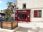
16, pl. de l’église, 37140 Bourgueil
19, rue Thiers, 37130 Langeais
Access and parking
The yellow route starts on Place du Champ de Foire. There’s a buzzing market here every Monday all year round.
Parking :
rue du 8 mai 1945
Report a problem or an error
If you have found an error on this page or if you have noticed any problems during your hike, please report them to us here: