
Between the Loire and Indre rivers
Bréhémont
Between the Loire and Indre rivers
Easy
3h
12,3km
+76m
-77m
Loop
Embed this item to access it offline
Attachment
- Downloadpdf
Balade en Touraine_Entre Indre et Loire_Bréhémont
Credit: Balade en Touraine : Entre Indre et Loire - Bréhémont - Département Indre-et-Loire
Description
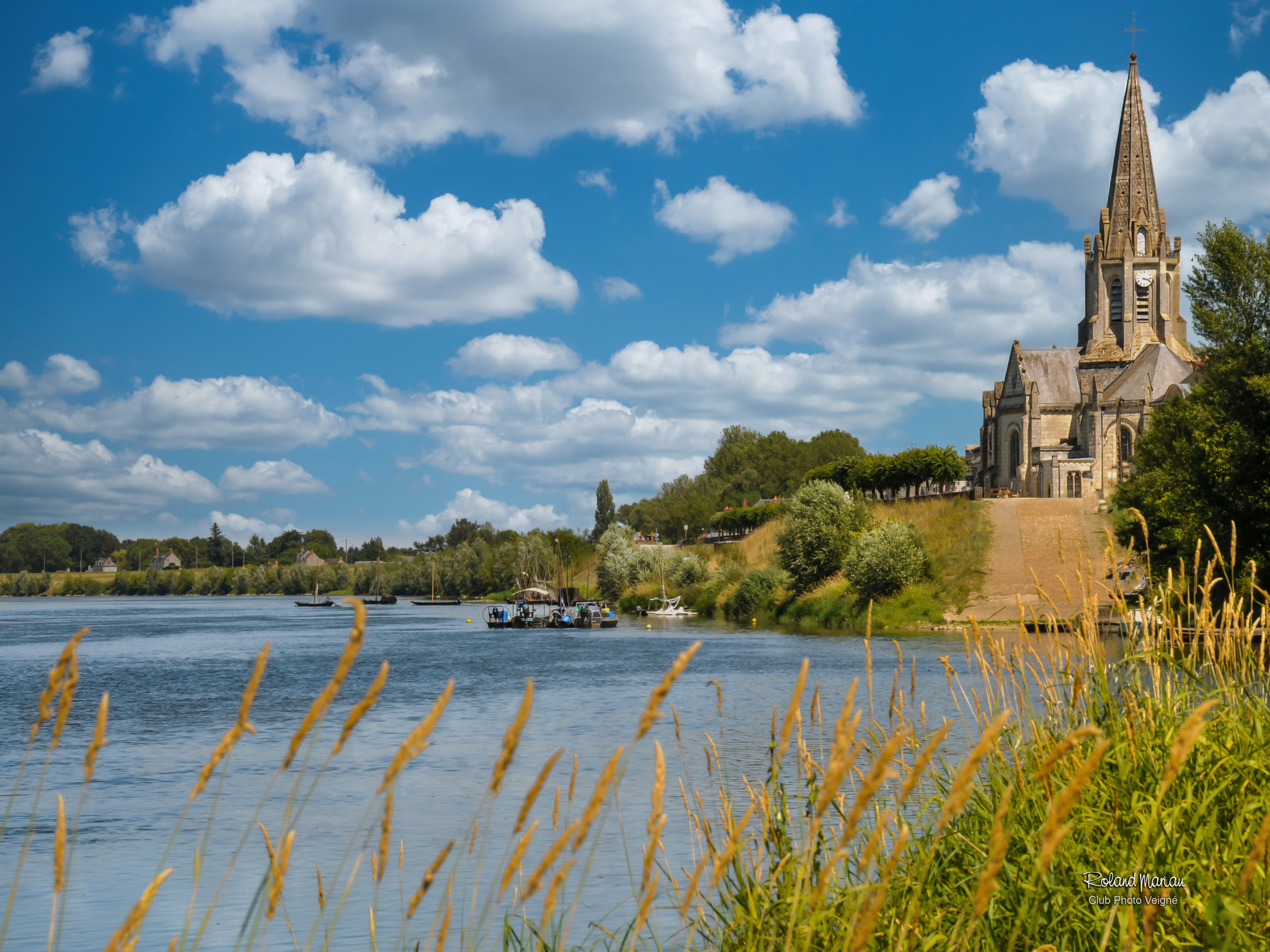
- Saint-Madeleine church
The 12-km starts on Place du 8 Mai, at the sign you'll find at the end of the little tarmac road behind the school. Take a moment to admire the Saint-Marie-Madeleine Church, its choir and stained-glass windows. It was built in 1843 and is one of the few churches with a "disoriented" layout in France. The choir tends to be east-facing but this one faces west. Turn left and follow the yellow markers. Go past the cemetery. Turn right at the stop and then left along the signposted trail. - Dyke
Go right again onto the little tarmac road then left on the first path you see until you reach the dyke and turn right. Cross a tarmac road an go straight on. Cross a path then carry on between two rows of poplar trees. - Milly
You can now see Milly, a fortified farm. Go straight on and you'll pass a bridge stone on your left. Turn left at the crossroads then go over the stone bridge. Turn left at the top of the tarmac road and then left again before the bridge. - Les Bardeaux de l'Indre
Go along the Indre and you'll see a small island in the middle. Follow the Loire à Vélo path. You're entering a Sensitive Nature Area, Les Bardeaux de l'Indre. Along the way, you'll see the Routoir de Butte aux Oies and Routoir de Belette (ditches that were used to soak hemp boots)./ Go straight on. At the end of this path, take the little road on the right. - The old Cher river
Leave the stone bridge on your right and carry on along the grassy path ahead (along the old Cher river), the Cher's former riverbed that was diverted in the late 18th century. Turn right at the end onto the D119 road and cross the little bridge as per the signage. - The ancient vineyards
Turn left onto the sandy path just before the 2nd bridge and carry on ahead. Turn right at the crossroads, cross the 2nd bridge then take a sharp left after the bridge. Go straight on until the end of the path. - Bridges
Turn left after the iron bridge an cross the stone bridge. Follow signs for "circuit n°2" at the crossroads and go straight on along the dyke. Cross a path with a stone bridgeon either side and continue straight on. You'll get a lovely glimpse of the hilltop village of Saint-Michel-sur-Loire to the right. Cross the D119 road then turn right (after the sewage treatment plant). - Bréhémont village
Go straight on when you reach Bréhémont on Rue des Foucaults then turn right and head down Rue du Croissant on the left. At the end of the street, turn left or go up the narrow staircase. Cross the wide street and go down the Bréhémont port, which is also famous for its recently restored public urinal. - Port
The heyday of the oldest cobbled port in Touraine was the 19th century because of the increase in trade from hemp growing and fhising. Rich traders at the time built countless houses by the port that bear witness to the great lifestyle of the region.
- Departure : Place du 8 Mai
- Arrival : Place du 8 Mai
- Towns crossed : Bréhémont
Forecast
Altimetric profile
Information desks
4 Rue du Château, 37190 Azay-le-Rideau
Report a problem or an error
If you have found an error on this page or if you have noticed any problems during your hike, please report them to us here: